
 MikeSully330
1 Answer
 country bumpkin
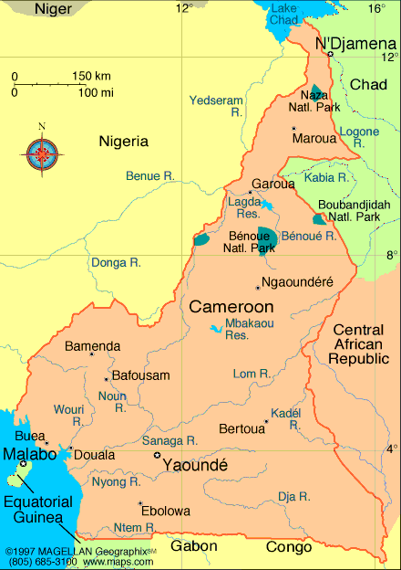
Cameroon map
Geography
Cameroon is a Central African nation on the Gulf of Guinea, bordered by Nigeria, Chad, the Central African Republic, the Republic of Congo, Equatorial Guinea, and Gabon. It is nearly twice the size of Oregon. Mount Cameroon (13,350 ft; 4,069 m), near the coast, is the highest elevation in the country. The main rivers are the Benue, Nyong, and Sanaga.
Read more: Cameroon: Maps, History, Geography, Government, Culture, Facts, Guide & Travel/Holidays/Cities | Infoplease.com http://www.infoplease.com/ipa/A0107382.html#ixzz2Rj8MAkSv
| 12 years ago. Rating: 5 | |


Top contributors in Movies category
Unanswered Questions
66mborg
Answers: 0
Views: 7
Rating: 0
Đá gà thomo trực tiếp chất lượng HD tại MCW67
Answers: 0
Views: 7
Rating: 0
Big88 – Nền Tảng Cá Cược Trực Tuyến Hấp Dẫn Cho Người Chơi
Answers: 0
Views: 10
Rating: 0
Sumclub Cổng Game
Answers: 0
Views: 7
Rating: 0
river4io
Answers: 0
Views: 9
Rating: 0
Eq9au com
Answers: 0
Views: 10
Rating: 0
Eq9au com
Answers: 0
Views: 11
Rating: 0
Mitom Tv
> More questions...
Answers: 0
Views: 11
Rating: 0